Seattle is famous for many things: world-class coffee, hospitals, music, tech, outdoor recreation, the list goes on. We are also a famously difficult place to go out driving in the snow. Anyone who has braved our steep hills during a snow or ice storm knows that our landscape makes for a tough commute.
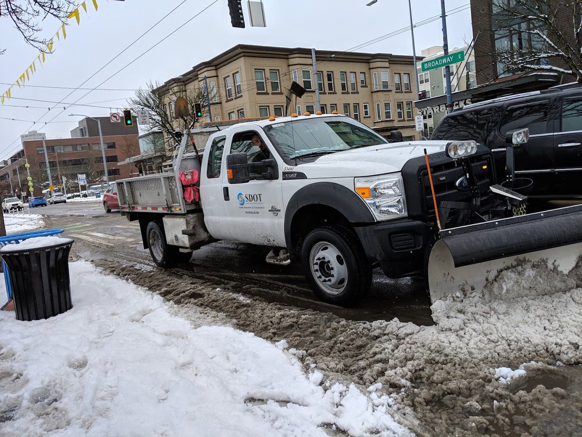
The City of Seattle has made a lot of investments and improvements in our snow response over the years. When winter storms are in the forecast, the Seattle Department of Transportation (SDOT) mobilizes its crews to pre-treat streets in preparation for snow and ice conditions.
As snowfall begins to accumulate, SDOT’s fleet of trucks systematically plows roads, keeping a network of key arterials and priority routes clear for transit and essential travel. But steady snowfall can cover a cleared road quickly. Seattle residents needed a way to see which streets were cleared and when.
Open Data at Work
SDOT worked closely with Seattle Information Technology to create a Winter Weather Response Map that shows how recently streets have been serviced in near real-time. “It uses AVL, which is automated vehicle location data, and there are sensors that are on the plows,” explains Brandy Balansay, the Seattle IT analyst who manages the applications feeding into the map. “When there is a snow event or winter event, the drivers have to flip a switch, turn it on, and once that’s on, it begins to collect data.”
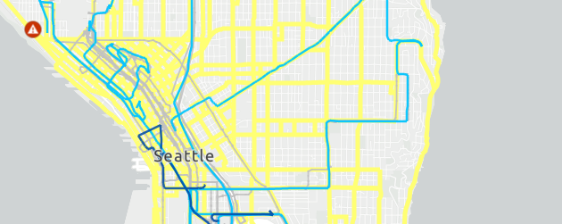
The tracking data then shows up on the Winter Weather Response Map, which uses color intensity to distinguish roads serviced in the last one hour, one-to-three hours, and more than three hours. The map also pulls from other City data sources to show street closures and sidewalk maintenance status all in one place. (The interactive map does not capture 100% of snow plow movements, since contractor-operated plow vehicles do not carry the tracking equipment, and some tracking sensors can become damaged during 24/7 winter snow and ice storm response operations.)
Adapting to Meet Demand
In earlier years, the web map was a victim of its own success. Sudden surges in website traffic during snow and ice events would often bring the map servers to a crawl. To keep up with demand, Seattle IT worked with Esri, the company that hosts many of Seattle’s web maps, to increase capacity for the map during the winter months.
“After the initial couple seasons in this role I was like, ‘Snow can stay up in the mountains!’” jokes Balansay. “But now, once we do our test run in the fall and we know everything is up and running, we can enjoy the snowfall because we know that it works.”
Seattle IT and SDOT continue refining and adding features to the Winter Weather Response Map during the off-season, while preparing for the next winter. An ADA-accessible text version offers street temperatures and locations of road plowing designed for screen readers. Staff added translated information to the map in 2023 for people who read in other languages.
Keeping Seattle Moving in the Snow
The Winter Weather Response Map lies dormant most of the year, but when icy, snowy weather arrives, the interactive web map helps inform over a quarter of a million requests from the public, per snow event.
Seattle’s infrequent snow and ice storms can take a big toll, sometimes shutting down schools and businesses and creating difficult conditions. The Winter Weather Response Map is a tool to help residents travel with safety and confidence during inclement weather. “It takes a lot of work to make sure everything is up and running and prepping for a storm, but when it needs to, it shines,” says Balansay.
Make sure you’re ready for the next winter storm or other emergencies by signing up for Alert Seattle, and follow SDOT on social media for all the latest on getting around Seattle. You can also prepare year-round by visiting SDOT’s winter weather web page for a variety of informational resources, or visit the City of Seattle’s overall winter weather website.
Mayor Harrell’s One Seattle Data Strategy creates a shared vision for how we can better collect, use, manage, communicate, and lead with data. Check out more examples of how Seattle’s data and analytics are being put to use for residents.